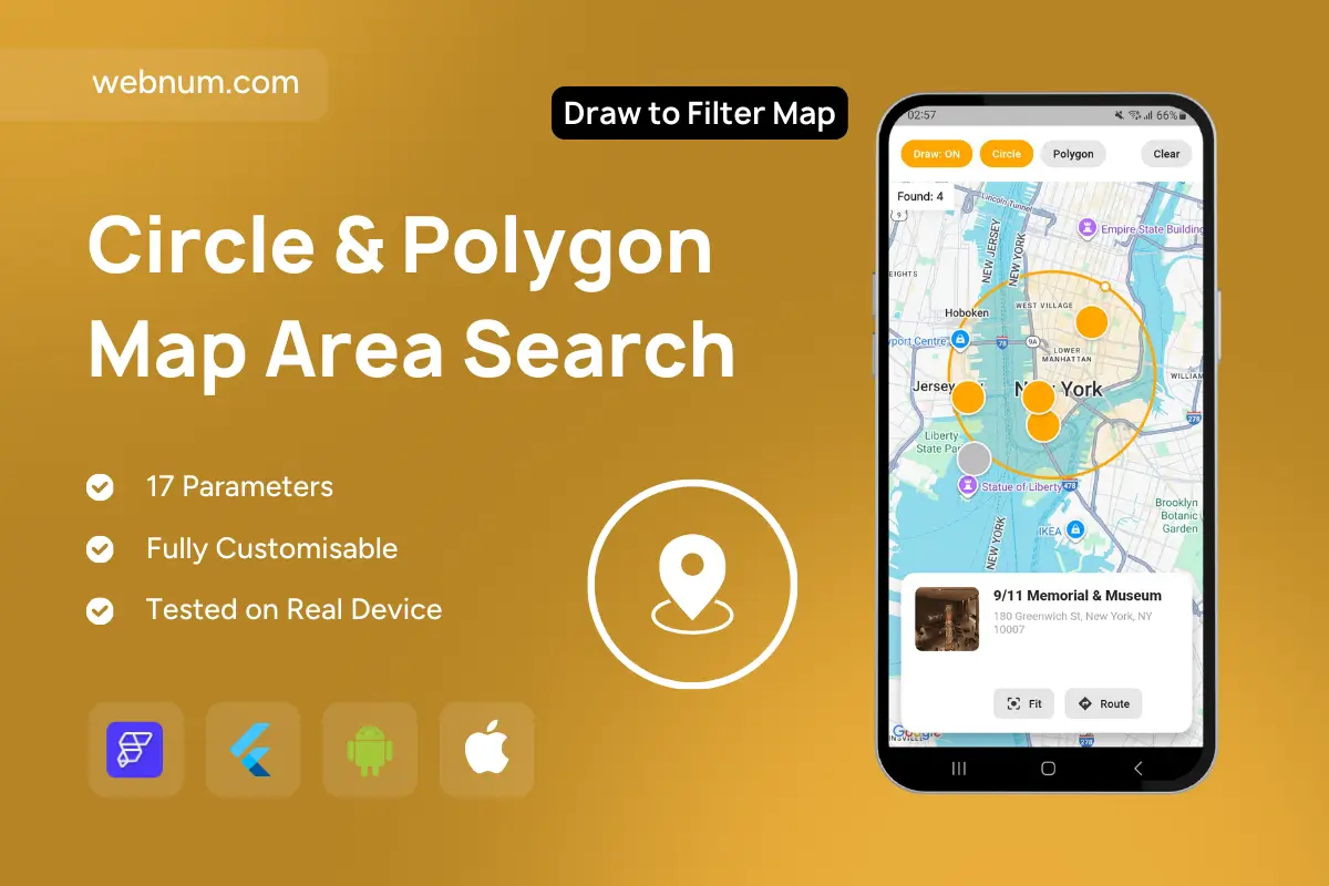
Interactive map tool that lets users draw a circle or polygon to instantly filter locations inside the selected area. Results are counted (“Found: n”), highlighted on the map, and shown in a bottom card with photo, address and quick actions (Fit / Route).
Functionality
Two modes: Circle (set center & drag radius) and Polygon (tap to add vertices; close to finish).
Live result counter and highlighted pins for all items within the shape.
Bottom detail card with image, title, address, rating/status, and actions: Fit (zoom to shape) and Route (open navigation).
Draw toggle & Clear controls to enable/disable drawing and reset the map.
Draggable/resizeable geometry with visual handles; updates results in real time.
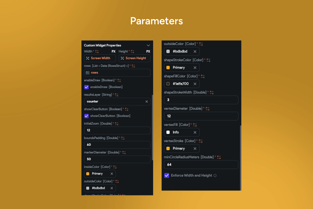
Configurable styling (stroke/fill color, opacity, width) and units (km/mi).
Callbacks for onShapeStart, onShapeChanged, onShapeComplete, onClear, onResultTap.
Works with any dataset (POIs, listings, events); supports clustering/markers outside the area.
Use cases
Real estate & rentals: Search homes inside a custom neighborhood or within a radius of a landmark.
Retail & services: Find stores, pharmacies, or partners within delivery/service coverage.
Travel & leisure: Discover attractions or restaurants within walking distance.
Logistics & field ops: Define geofences for jobs, pickups, or incident areas.
Events: Filter concerts/meetups inside a drawn venue zone.
Safety & emergency: Visualize impact radii and affected assets.
Keywords
Geofence, draw polygon, radius search, circle selection, lasso select, area filter, custom shape, map pins, Google Maps, POI search, bottom sheet, fit to bounds, route, interactive map UI.