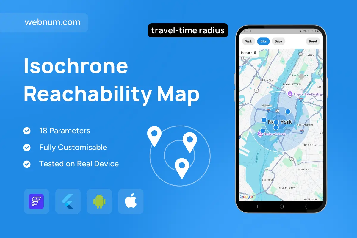
An interactive map that draws travel-time reach rings (isochrones) around the user and shows how many places are within reach for each transport mode. Switch between Walk, Bike, and Drive to instantly update the coverage area, surface only the relevant POIs, and open a rich place card with actions (Center/Focus, Route).
Functionality
-
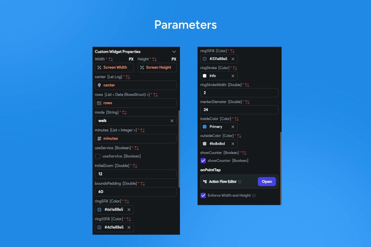
One-tap mode chips (Walk/Bike/Drive) with mode-specific speeds and dynamic radius.
-
Concentric reach rings visualize your coverage; live counter of in-range places.
-
Marker clustering; tap a marker to open a bottom sheet with name, photo, address, and Route / Focus / Center actions.
-
Works from current GPS position or any map center; quick Reset to clear overlays.
-
Smooth updates on pan/zoom; adaptive styling for light/dark maps.
Use cases
-
“What’s within 15 minutes?” exploration for cafés, museums, gyms, etc.
-
Real-estate search: walkable/bikeable neighborhoods around a listing.
-
Local discovery for city guides and travel apps.
-
Service coverage checks (courier radius, store catchment).
-
Event planning: choose venues reachable by attendees without long travel.
Keywords
isochrone map, reachable area, travel-time radius, drive-time polygon, walkability, bike radius, catchment area, POI clustering, bottom sheet, route action, geospatial filter, coverage rings