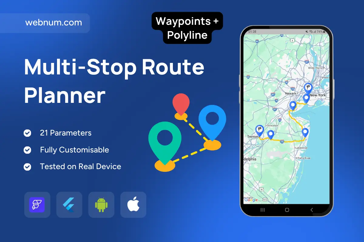
Plan and visualize complex trips with multiple stops on an interactive map. Users drop or select waypoints, and the route is drawn as a snapped polyline from origin to destination (finish flagged), including any mid-points in order. Perfect when you need to preview logistics flows, delivery rounds, or road-trip itinerariesβnot just a single hop.
Functionality
-
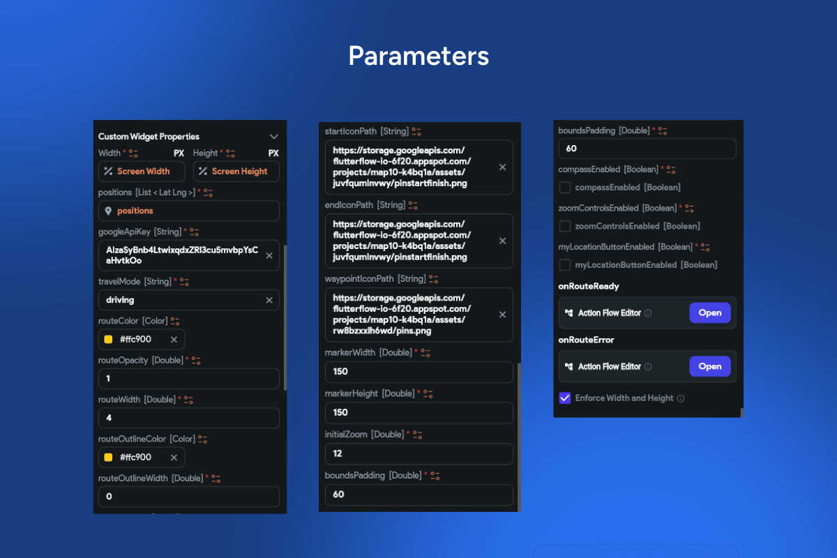
Add, remove, or reorder waypoints (origin, intermediate stops, destination).
-
Auto-draw road-snapped polyline between points; supports recalc on every change.
-
Optional drag markers to fine-tune positions; long-press to add new stops.
-
Live distance & ETA (per leg and total) via Directions API; metric/imperial.
-
Distinct markers for start/finish; custom icons/colors for categories.
-
Fit-to-bounds, recenter, and zoom controls; light/dark map styles.
-
Validation (max stops, duplicates), offline fallback (straight-line polyline).
-
Export/share route data (GPX/GeoJSON/URL) and persist recent plans.
Use cases
-
Delivery & field-service sequencing (multi-drop routes).
-
Fleet dispatch and proof-of-coverage demos.
-
Sales visit planning and territory optimization.
-
Travel/road-trip itinerary builders with intermediate attractions.
-
School bus / shuttle routing visualization.
Keywords
multi-stop routing, waypoints, polyline, road-snap, route builder, distance & ETA, draggable markers, start/finish, Google Maps, itinerary planner, delivery route, fleet logistics.
Multi-Stop Route Planner
- Fixed price & scope
- Pixel-perfect UI/UX
- App Store & Google Play submission
You may only use this template for one project. For more details, please read the Marketplace Terms of Service.