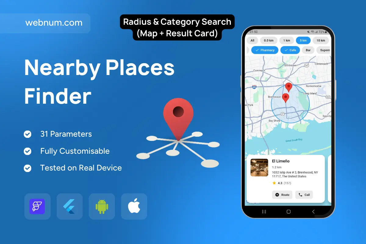
Discover points of interest around a chosen center with chip-based filters for distance and category. A draggable pin defines the search center; a translucent circle visualizes the radius (0–10 km). Results appear as map markers and a smart result card with photo, name, distance, address, rating, and quick actions like Route and Call.
Functionality
Distance chips (0, 1, 5, 10 km) and category chips (e.g., Grocery, Pharmacy, Café, Bar).
Draggable/map-centered pin with radius overlay for instant geofenced queries.
Result markers + bottom card: image, title, distance, full address, rating/count, CTAs (Route opens navigation; Call dials).
Auto-sort by distance and rating; supports “open now/near me” logic.
Tap marker ↔ highlights card; swipe cards to browse nearby options.
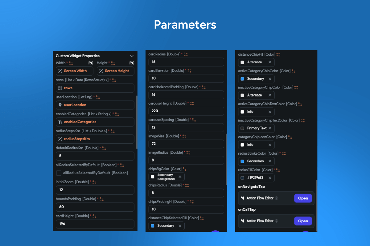
Optional: recenter to user location, change radius, multi-language labels, dark mode.
Use cases
Store & clinic locators (retail, pharmacies, banks).
Food & leisure discovery around a hotel or meeting point.
Operations apps to verify coverage within a geofence.
City/travel apps to surface essentials within walking/driving range.
Keywords nearby search, radius filter, category chips, geofencing, Google Maps, place details, route CTA, call CTA, location discovery, store locator.